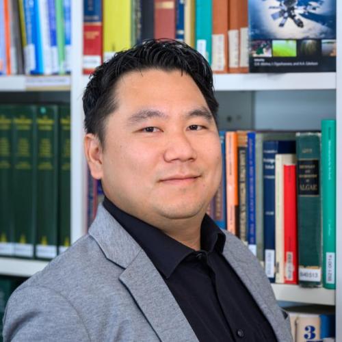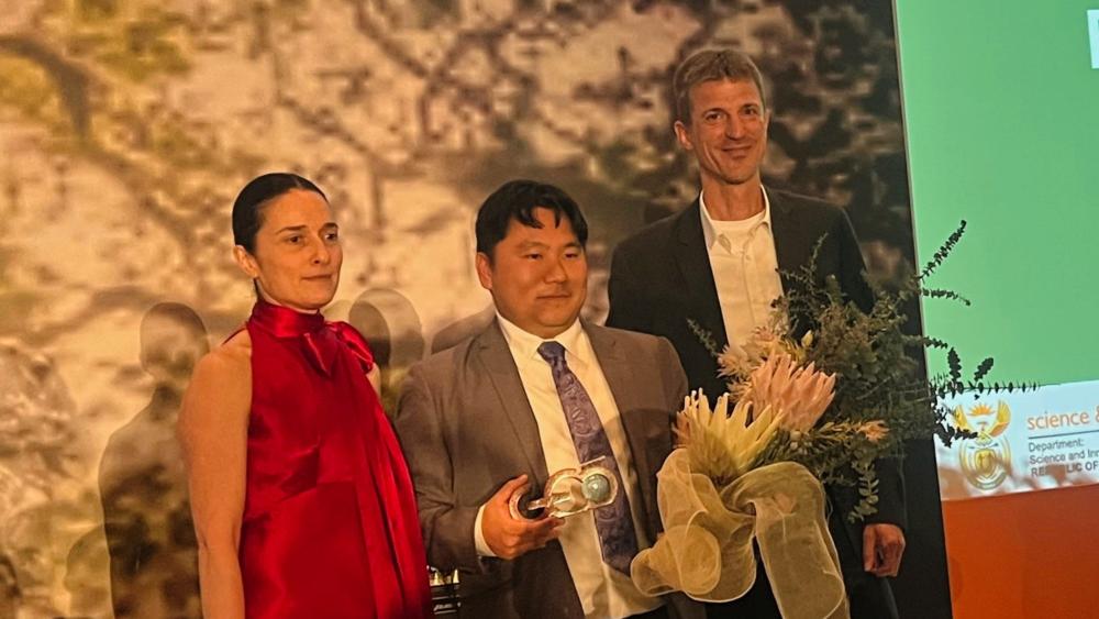
Yesterday, at the GEO Ministerial Summit in Cape Town, South Africa, IGB scientist Dr Igor Ogashawara (in the middle) was honored with the GEO Emerging Leader Award. | Photo: GEO
Mr Ogashawara, congratulations on your award! What pleased you most concerning the nomination?
One of the things mentioned in the nomination file was that I am very committed to promoting young scientists in a variety of ways. This made me very happy because I am the person that I am today because my interest in science was awakened and encouraged at an early age. There are now many opportunities to meet others, especially young people, who are enthusiastic about research. For example, I have just participated as a mentor in a hackathon to develop digital solutions to water problems for indigenous communities . I also set up the GEO AquaWatch Early Career Society, which I am now a co-chair.
That sounds inspiring! Can you tell us more about the encounters and experiences that motivated you to get involved with water and societal issues?
My scientific passion for water started at the age of 12. You have to realise that water quality is a very important issue in Brazil. Because of our climate and high levels of water pollution, we often have to deal with blue-green algae blooms during the entire year. The water quality from residuals of fish farming is also a big issue in the country. In my hometown. São Carlos, there was an extension project lead by Dr José Galizia Tundisi at the International Institute of Ecology where I was trained to mentor other students on the importance of freshwater. Later, at the age of 15 I got a fellowship to work on a project accessing the impact of cage fish farming on water quality of reservoirs.
That's quite impressive for a young person...
It was exciting to do my own research and I continued during my high school. By the time I started my bachelor degree, I had already completed three major projects, won awards and travelled to international conferences in Poland, Germany, Russia and the USA. Interestingly, I won my first international award in Germany in 2006: third place in the Environmental Science category at the International Conference for Young Scientists (ICYS) in Stuttgart. This project was also about water, how aquatic macrophytes could take up zinc and nutrients.
Are these early successes also a reason why you are now committed to supporting young scientists?
Yes, I would like to pass on these early positive experiences with science and support other young people as a mentor. I have also stayed committed to the subject: I studied geography and am a water researcher at heart.
What is your current research focus?
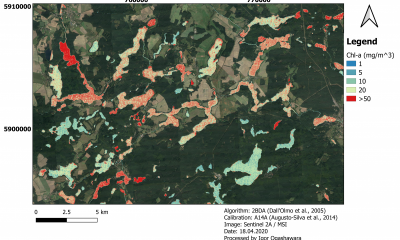
I look at how remote sensing data, such as satellite imagery, can be used to improve environmental monitoring of water bodies. Traditional water monitoring methods have their limitations: Direct measurements on water bodies are only possible at certain points, some water bodies are difficult to access, and researchers cannot and should not travel around the world all the time. Satellite data can be very helpful in providing an spatial overview or recording environmental changes in real time and over time. For example, algal blooms can be quickly detected and localised. We also made this point to the ministers at the GEO Ministerial Summit in Cape Town. We need this political support to get better sensors on satellites and to improve the accessibility and international exchange of data.
So is the use of remote sensing for environmental monitoring still in its infancy?
No, not really. Satellite data have been used for terrestrial systems since the 1970s to record and assess environmental changes. One example is my own country, Brazil, where it has been used for decades to document the decline of the rainforests. It has also long been used in marine science since 1980s. In comparison, remote sensing has not been used for inland waters for as long. It is also not easy to transfer methods from marine systems to freshwater. After all, ocean color is mainly influenced by phytoplankton while freshwater contains humic substances, plankton, suspended matter and other material from the surrounding land.
What are you doing to solve this problem?
Adapting the technology to the needs of freshwater ecology remains an exciting challenge. In 2028, for example, there will also be new satellites that can better detect the different phytoplankton pigments. That's also part of the research – working closely with the aerospace industry. I never wanted to be an astronaut, but I am fascinated by the unique perspective of the Earth. That's why I really enjoyed my time at the Brazilian National Institute of Space Research (INPE), where I did my Master of Science in Remote Sensing.

"I never wanted to be an astronaut, but I am fascinated by the unique perspective of the Earth."
Dr Igor Ogashawara
How did you get to IGB, where you worked on the CONNECT project?
It was one of the funniest coincidences of my life. I had just published a book: "Bio-optical Modelling and Remote Sensing of Inland Waters". I was looking for the cover to put in a presentation when I came across a job advertisement for the CONNECT project at IGB, which had nearly exactly the same title as the book. It sounded like a lucky punch. The deadline was in a few days and I had to hurry, but it worked. At the time, I was still in the US at Indiana University – Purdue University Indianapolis (IUPUI), where I was doing my PhD on monitoring cyanobacterial blooms in water bodies. I could have stayed there, but I was very interested in the IGB and its LakeLab – although my future colleagues warned me in the online application interview that Lake Stechlin is not in Berlin. Actually, I love the landscape around.
In the CONNECT project, you then used the of lakes in Brandenburg as a model to investigate how remote sensing can be used to improve water monitoring. What happens next in your life?
Yes, CONNECT was a very exciting project. Also because we tackled water quality monitoring from different methods: monthly sampling, high-frequency sensors and remote sensing. We took samples from the lakes at regular intervals and synchronised them with satellite overflights. This gave us a basis for improving bio-optical models for calculating the chlorophyll content from remote sensing data. I am now involved in the IGB project Water-ForCE: Water scenarios for the use of Copernicus. The European Copernicus programme aims to establish a modern and efficient infrastructure for global earth observation with satellites. We are developing a roadmap on how the various services of this programme can be brought together for water issues. All of this will help to record the water cycle – precipitation, soil moisture, extent and quantity of water – as well as the water quality of lakes, rivers and wetlands in a completely new spatial and temporal dimension. This will ultimately be a milestone for drinking water production, food production and ecology. I am looking forward to it!