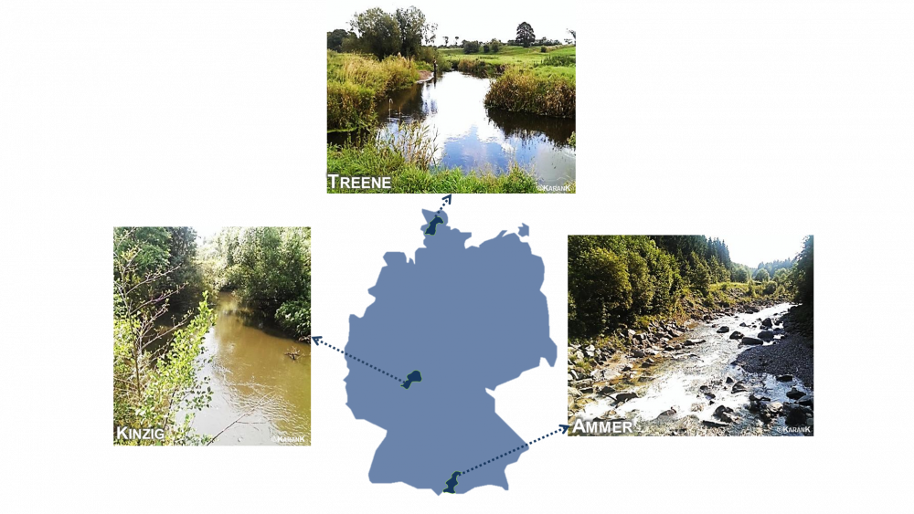
The three study catchments of GLANCE (Source: Dr. Karan Kakouei)
Back to the IGB project website of GLANCE >
Lowland - Treene
The Treene is a lowland, sand and gravel dominated river in the northernmost federal state of Germany, Schleswig-Holstein and is the largest tributary of the river Eider. Discharge averages 3 m3 s-1 for a catchment area of about 480 km2 with ground elevations from 2 to 80 m ASL. As 80 % of the catchment is agriculturally used, most of the wetlands are drained and the channels are anthropogenically modified. Near-natural conditions and meandering sections are occurring occasionally.
Low-mountaineous region - Kinzig
The Kinzig is a submountaineous stream located in the Federal State of Hesse and drains into the river Main, east of Frankfurt a.M. The catchment lies in the central low-mountain range of Germany with ground elevations from 98 to 627 m ASL. Mean discharge is 10 m3 s-1 for a catchment area of about 1060 km2. Nearly half of the catchment area is covered by forest while 30 % of it is agriculturally used. Although the water system is partially modified due to agricultural or urban needs, many highly dynamic and near-natural sections can be found as well. The Kinzig dam is located in the upper third of the catchment and has, amongst others, regional importance for flood control.
Alpine region - Ammer
The river Ammer belongs to the Northern Limestone Alps in the Federal State of Bavaria (South Germany). Its upper section can be characterized as a torrent with steep gradients, dominated by gravel and stone substrates. Mean discharge is 16 m3 s-1 for a catchment area of about 710 km2 with ground elevations from 533 to 2185 m ASL. Half of the catchment area is agriculturally used, mainly as grassland, and 45 % is covered by forest. About half of the flow path is considerably to strongly modified, while almost 50% remain in a near natural state.
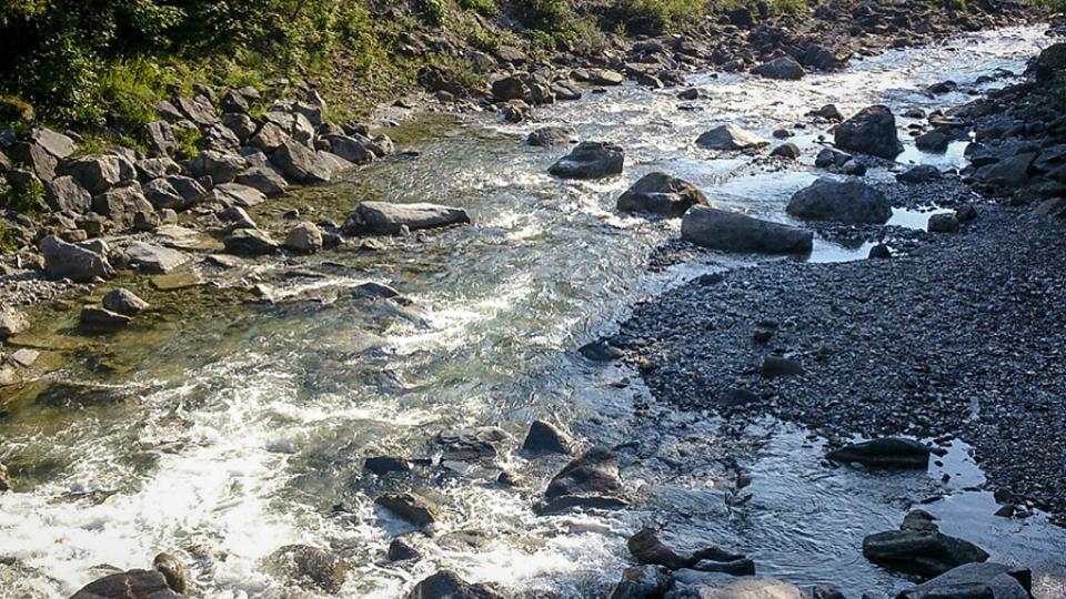
Ammer
Source: Dr. Karan Kakouei
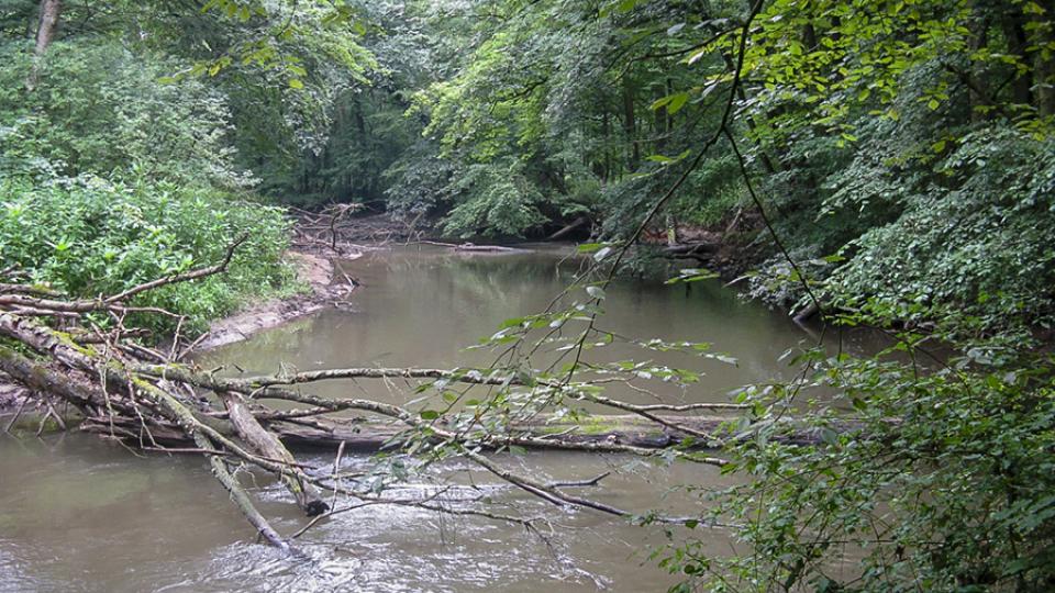
Kinzig
Source: Dr. Karan Kakouei
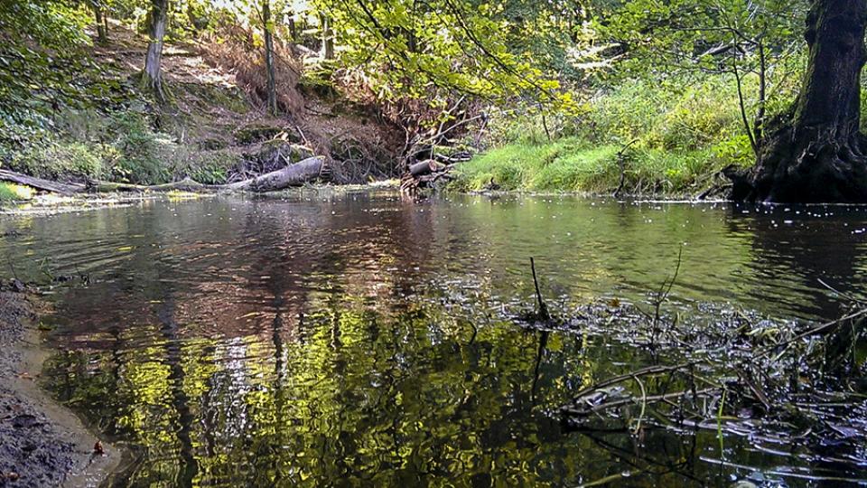
Treene
Source: Dr. Karan Kakouei